Converting a CSV file to a shapefile
using Python
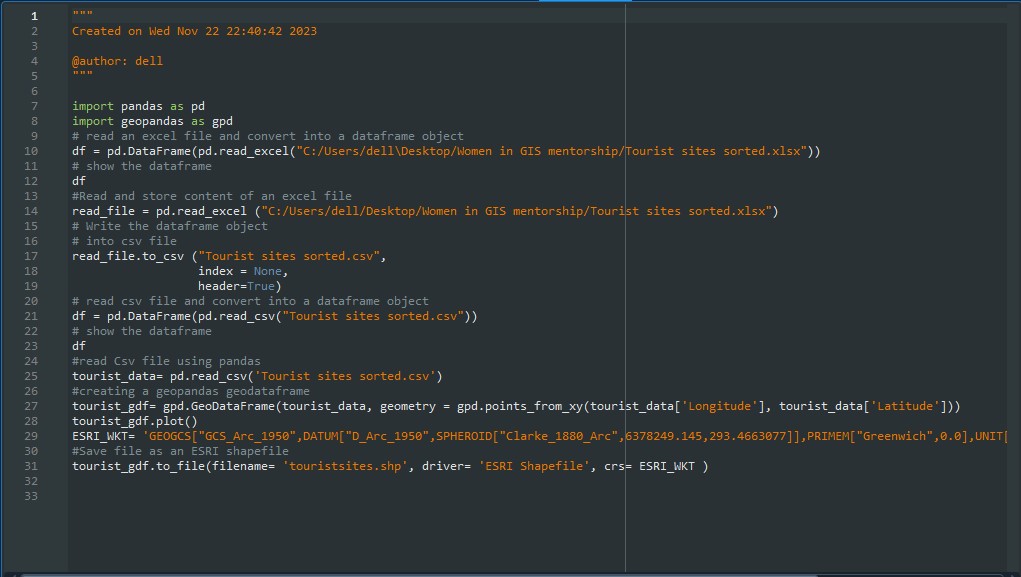
In this exercise a csv file with tourist sites in Zimbabwe was converted into a shapefile through the use of Python.
Professional portfolio showcasing projects in Geographic Information Systems (GIS), remote sensing, computer programming, spatial statistics, and data science — including data analysis, visualization, and Jupyter Notebook-based workflows. Designed and maintained by @pschisenga
In this exercise a csv file with tourist sites in Zimbabwe was converted into a shapefile through the use of Python.
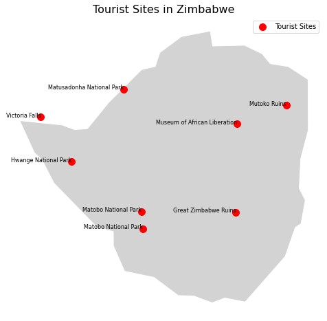
A map showing the tourist sites in Zimbawe was created through the use of the Geopandas and MatplotLib libaries in Python.
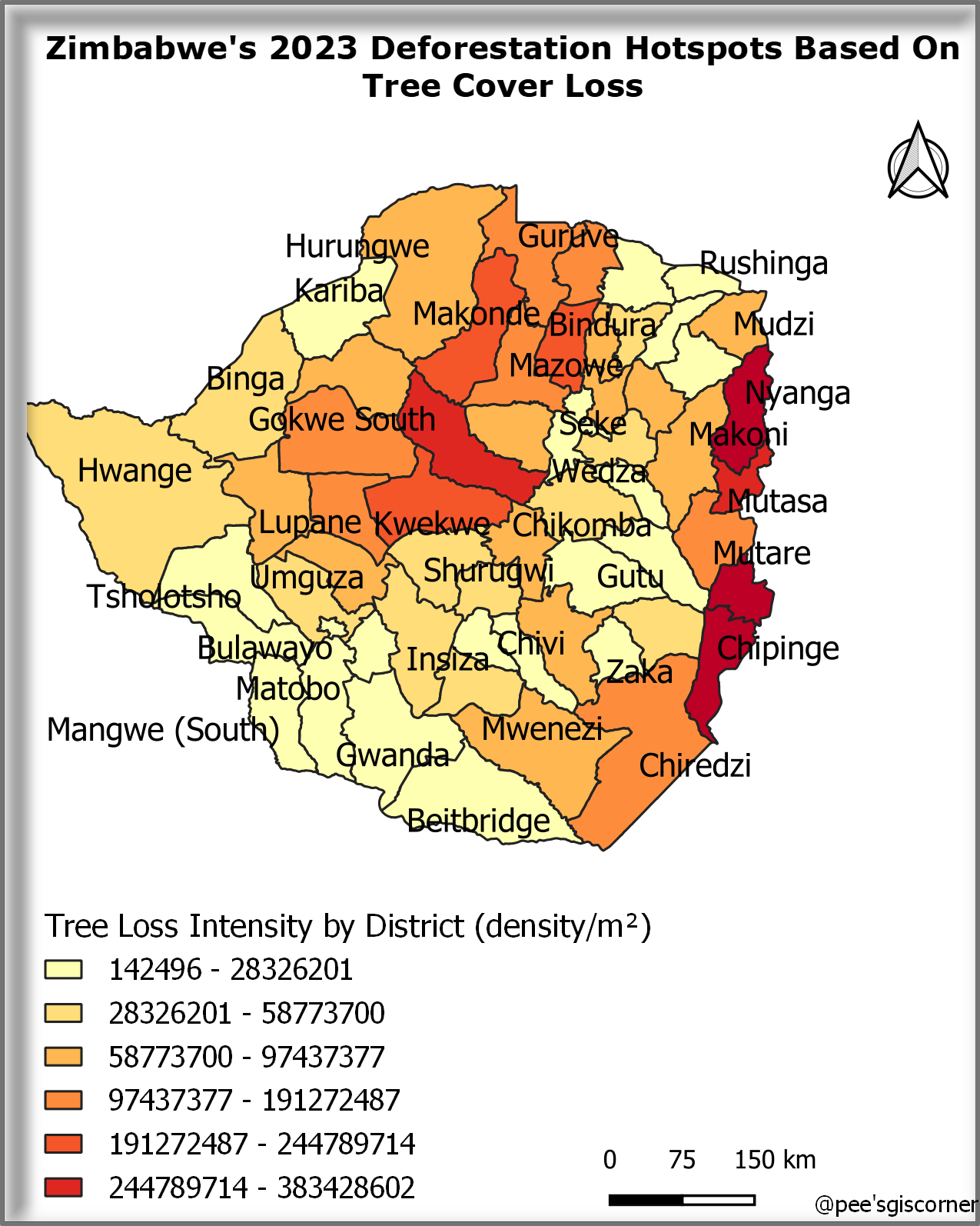
In this write-up, I share how I created a deforestation hotspot map using QGIS, analyzing tree cover loss data from 2023. I break down my workflow, from data processing to visualization. Authored by me, this post offers insights into geospatial analysis for conservation.
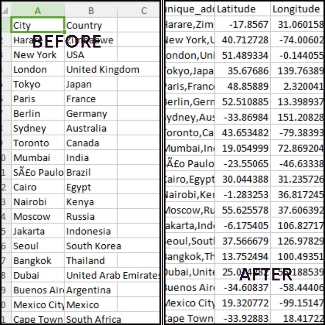
In this post, I will demonstrate how to geocode a list of world cities using Python and Nominatim.

Coming soon....